Enetai - Champlain-Hudson-Southern New England Coast, 2015
Part 2: July 15 to July 19, Waterford New York to New York City, 138 nautical miles
Wednesday, July 15 Waterford to Athens, 34nm

We were through the Champlain Canal but still had one more lock to join the natural, tidal, flow of the Hudson. This is the Federal Lock at Troy. The guidebooks neglected to mention that there are no lines hanging from the walls. Instead, there are vertical pipes inset in the walls. The lock is so large that our 'Enetai' did not span two of the pipes, so we were cantilevered off a single pipe as the wind blew down on us through the lock.


One last low bridge upstream of Albany, and then we saw a dock along a park and moored to put the masts up. How great it is to get the rig back up!

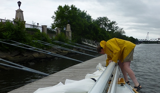
Gina walked around the park, which was really a nice park, including historic and natural history information particularly about the sturgeon in the Hudson, plus flooding and reclamation of the river. There's a pedestrian bridge over many lanes of highway to get to the city.
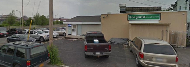
Pulling off the dock, we crossed the river and radioed the Albany Yacht Club, so that we could tie up to meet Bo's cousins Whit and Susan for lunch. They live in western Massachusetts, about an hour from here by car. Both the yacht club and a paper guide recommended a place called Teagan's for lunch. This was across a major intersection and down a back street. We ate out on the patio with unseen freeway ramps screened by brush, and serenaded by fire engines. This spot might have originally had a great view of the river, maybe 50 years ago, but it was cramped by the ramp.
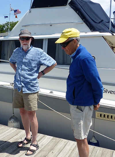
After paying for dockage and buying fuel at the yacht club, we sailed on down the river with the outgoing tide, passing a fair amount of barge traffic and watching as trains made their way along the shore.

I noticed some girls zooming erratically on two jet skis and as one fell off, the other girl circled but soon she fell off too and the jet skis started drifting away in the wind. One of the girls seemed to be panicking. The other caught one jet ski and tried to climb back on. They couldn't seem to get their act together. So we dropped our sails and started back up river to see if they needed help. They did have life jackets on thank goodness. We headed for them while they struggled to recover from repeated capsizes. Suffice it to say that they were quite drunk, and as they said they didn't want help we realized they were not going to drown wearing lifejackets and we moved on. And indeed, they finally managed to get themselves back on their PWCs. We saw them later, bombing down the river.
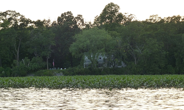
We anchored out of the channel near Athens.
Thursday July 16 Athens to Poughkeepsie, 39nm
We stopped at Athens' public dock to seek out morning coffee and a donut. We found only a Stewarts convenience store open early in the morning. They had coffee, anyway. There's a lot of old stuff along the river, including some historic brick lighthouses in the river, which the guidebook notes.
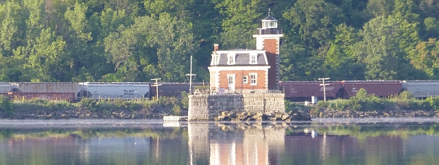
We drove down the river all day. We ducked out of the wind and current at Kingston NY (north of Port Ewen). It's a tight turn into the channel by an old light on a point, then up Rondout Creek to the public dock. This was a lovely spot, with lots of activity. We had a nice lunch while waiting for the tide current to reverse, and walked through the historic waterfront boat museum. We watched some youngsters fishing from our dock, it was quite exciting when they caught a big catfish, and some older boys came over and helped them

Barges and tugs continued to ply the waters, trains on both sides. The river gets fairly narrow, with no little coves, so we were looking to find a place to stop. We approached Poughkeepsie. There were rowing club houses on the East Bank and shells out on the water. (This rowing venue features in the book "Boys in the Boat".) Overhead was a very high railroad bridge running from bluff to bluff over the river that has been converted into a pedestrian walkway, "Walkway over the Hudson". Gina really wanted to walk across the river up there, whatever it took!
The guidebook mentioned a marina on the downstream side of Poughkeepsie, Shadows on the Hudson. The marina had been updated since the guidebook, and was accompanying a very large, ornate bar/restaurant.
Down by the docks however, sadly, the toilet facilities were modular "rest rooms on a trailer", small and, while highly air conditioned, more like a boat head (and not very clean). The marina seemed to be an overlooked appendage to the large restaurant.
The dock master said sure we could walk to the pedestrian bridge, there was a path, 'a bit rough in spots', along the river to get to an elevator to the Walkway over the Hudson.
Well, 'a bit rough' doesn't describe it, we ended up scrambling up and over a cliff, skirting weed smokers on the rocks to get to the promised elevator to the bridge. However, the elevator was out of commission. So we had to walk about as far as we'd already scrabbled, along the streets to get up the hill to it.
The view was Amazing! Everybody was up there! The wide roadbed (must have been double tracks) has been re-done with concrete. There are very substantial railings which reassure those who get vertigo. The air was still. We enjoyed seeing 'Enetai' way down on the river at Shadows. The bridge crossing is about a mile, but the elevated approach over Poughkeepsie roof tops is another mile to get from the bluff to the bridge. We'd walked for miles, and dusk was falling, and knew we couldn't scramble back over the cliff to get back. So we walked through some rundown neighborhoods w/ friendly people playing cards out in their front yards, trying to stay cool in the late afternoon.


Tired, hot and sweaty, we diverted into the bar in Shadows before going back aboard 'Enetai' in the marina. Nicely air conditioned. We were at the corner of the bar, and young couples kept posing in the corner behind us to get their pictures taken, so we set our timer and did one of us. 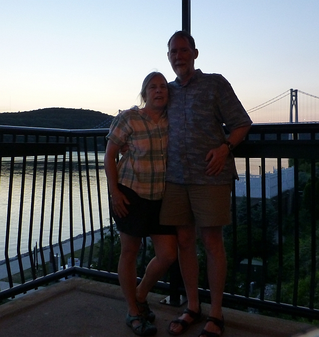
There was an amazing view of the suspension (highway) bridge from the bar.

Friday July 17, Poughkeepsie to Haverstraw, 32nm
Shortly downstream of Poughkeepsie a small, rocky island named Pollepel has what appears to be a crumbling Scottish castle. This is the remains of salvage mogul Francis Bannerman's empire, sometimes called Bannerman's Folly. The 'castle' ruins make for an interesting sight and the island offers a lee to tuck behind for some shelter. As we passed the island, trains continued to pass along each side of the river, mostly freight on the west and commuter rail on the east.


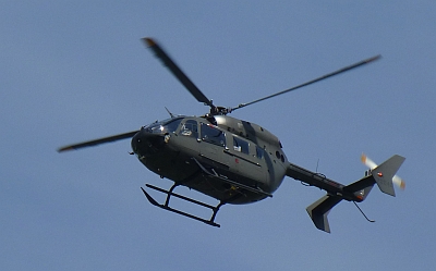
We passed through a gap, "Wey-Gat" or Wind Gate, between two high spots along the river at Storm King Mountain (nearing the end of the Hudson Highlands), downstream of which is the famous West Point military academy. A helicopter landing along the bank at West Point added some drama to the passage
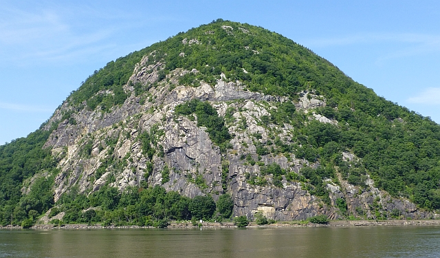
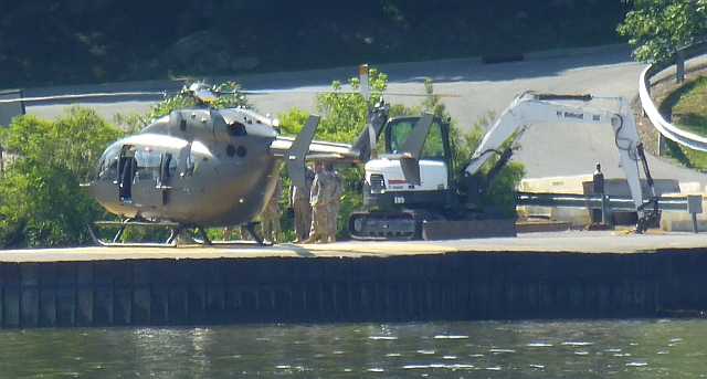

Watching the tide, we decided to anchor in a little indent on the west shore to wait for the ebb. It looked like there was an old landing, so we rowed ashore. Finding a path under the railroad tracks 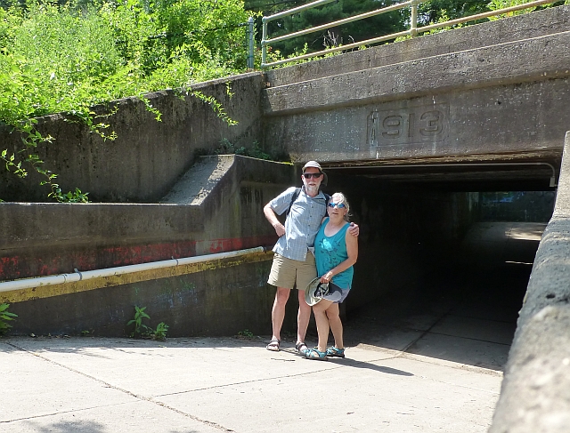

and up the hill, we were amazed as we came upon a huge, brilliant blue, fenced in swimming pool full of kids and families. Continuing along, we stumbled upon a zoo! This is at Bear Mountain just below the bridge crossing the Hudson. This was a really nice, old-fashioned place. There were bears, coyotes, raccoons, and many birds either mending or unable to fly and being cared for at the zoo. There were wild vultures passing time of day along with the bears.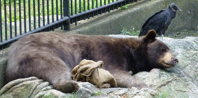
The Appalachian Trail passes through here, too. There were several fragrant through-hikers resting on the grounds. An historic trail museum showed where the area had been glaciated. There were separate buildings for reptles, birds, minerals glowing under black lights. There were taxidermy exhibits as well as the live animals.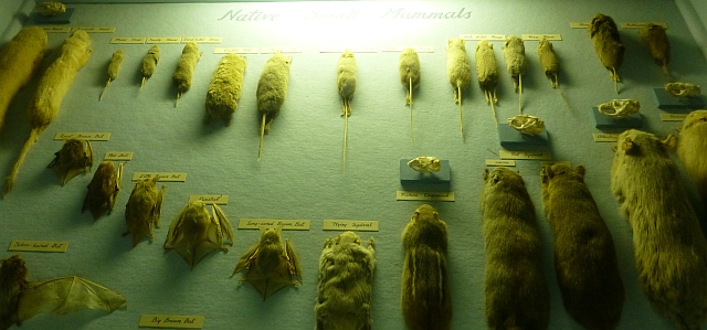
Trailside signs gave a bit of education, see 'Enetai' way below us, circled in yellow: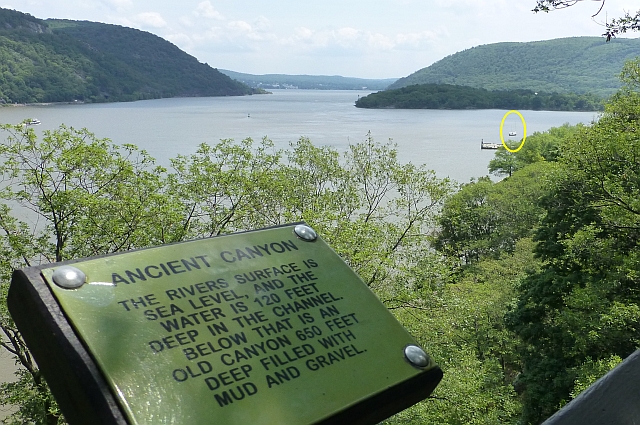
After leaving the Hudson Highlands, the river enters Haverstraw Bay, the widest point of the river at 3.5 miles (5.6 km) wide. The wind blew hard from the south and we tacked down to Haverstraw Bay w/ 2 reefs in the main, 1 in the mizzen.
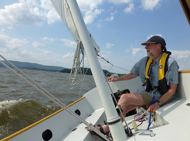
Looking for shelter from the wind, We dropped anchor off a park which turned out to be on an old, covered, landfill on the eastern shore at Croton-on-Hudson. This is a great anchorage in a south wind, but is exposed to fetch of the bay to the west. It was very hot, and we went for a swim among the motor boats. 
Saturday July 18 Haverstraw to New York City, 33nm
We arose to a huge rainstorm, with weather predictions for strong winds from the south to abate after noon, so we waited around half the day by taking a long walk. We rowed in to the sandy shore and found a trail through to a small road which connected to an overpass over the huge rail terminal, which we'd heard but not known just how big this was. This is for you train geeks out there: 
No services were to be seen, so we turned back and went a bit south into the park we'd seen. This is a former landfill site, with a dry but pleasant meadow strangely domed, but good for birds, evidently.
Back toward the water is a huge, grassy waterfront park with a sandy beach all along.
We rowed back and decided to up anchor and go for it! The ebb was beginning and the wind, still from the south had abated somewhat. But with the heat, we once again really needed ice. We contacted a marina on the radio but had a lot of trouble identifying exactly where they were in the clutter of boats and condos along the shore. Finally found them. No sign, goose poop on all the docks, but they did have ice! Even with waiting out the wind, we had to motor against 10 knots but at least we had tide and current sweeping us along downstream to NYC.
Shortly thereafter, the river forms the Tappan Zee and flows under the Tappan Zee Bridge, which carries the New York State Thruway between Tarrytown and Nyack in Westchester and Rockland Counties respectively. There is a new Tappan Zee Bridge under construction. They must be in a hurry because they seem to have barged in every crane available for the project

Cranes to the left of me, cranes to the right...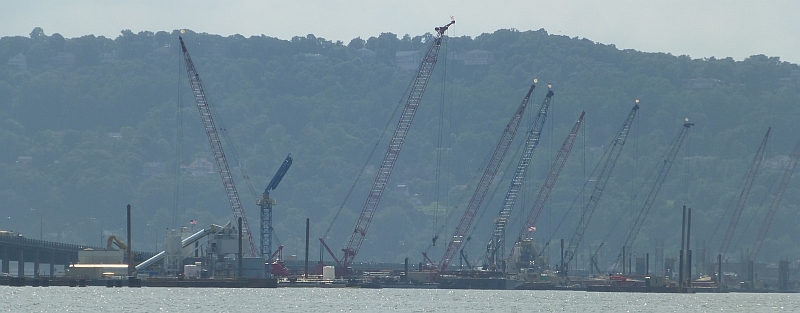
Here I am, stuck in the middle with youuu.
This turned out to be a long slog down the river, our goal: a marina somewhere near the mouth of the Hudson. More and more shoreline and boat activity as we headed south, and more buildings as we passed under the bridges crossing the Hudson 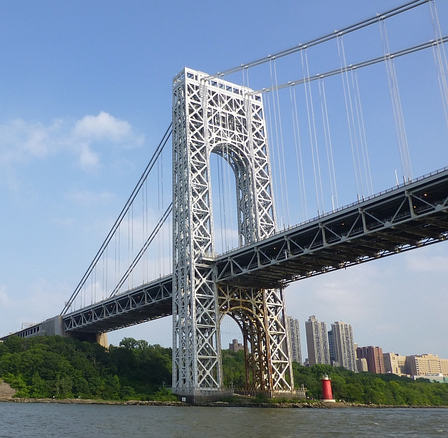


Golf driving range:
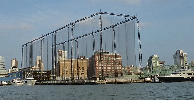
Four storys of golfers! Click photo for more detail.

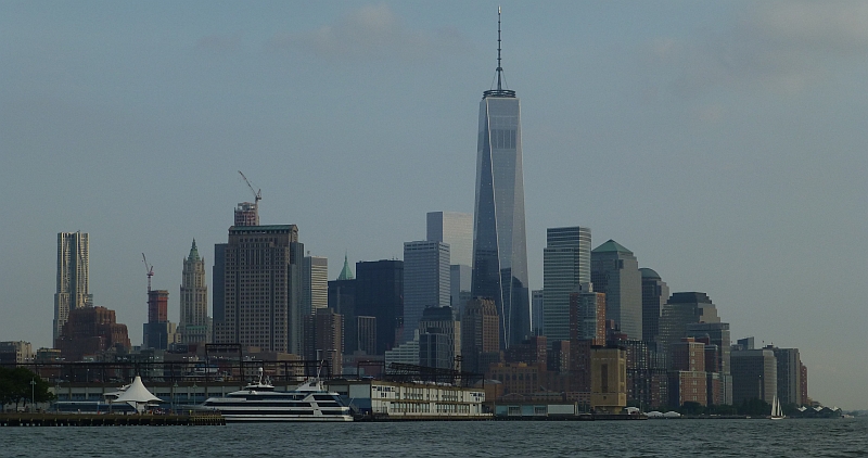
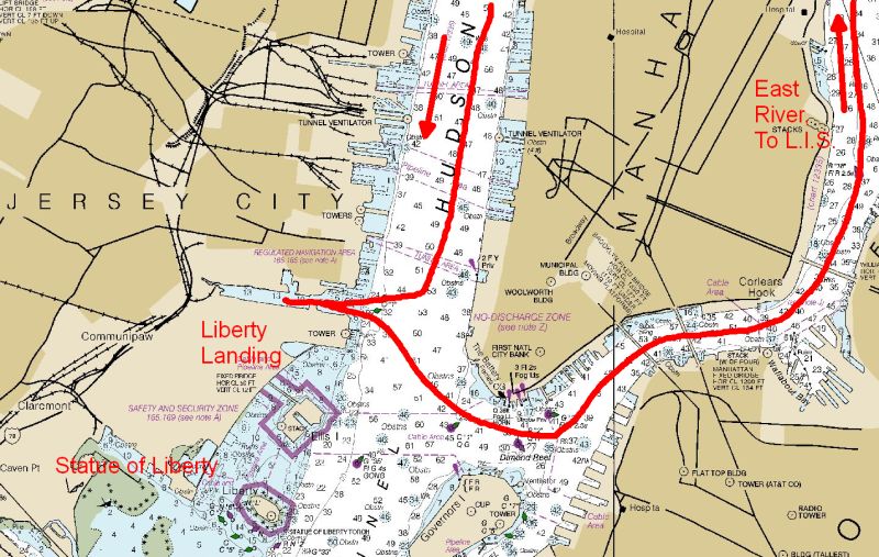
It was getting late and we called in to the Liberty Landing Marina to reserve a spot. It was still quite hot even though it was near dusk when we arrived.
It took some wandering around for us to locate our paperwork and move to the right dock. It was pretty noisy, and hot, and Bo was still hungry, and we could see a waterfront restaurant on the other side of the canal/cut from the marina. So, we got in our dinghy and rowed over to Surf City for some cold beer and a mahi-mahi burger.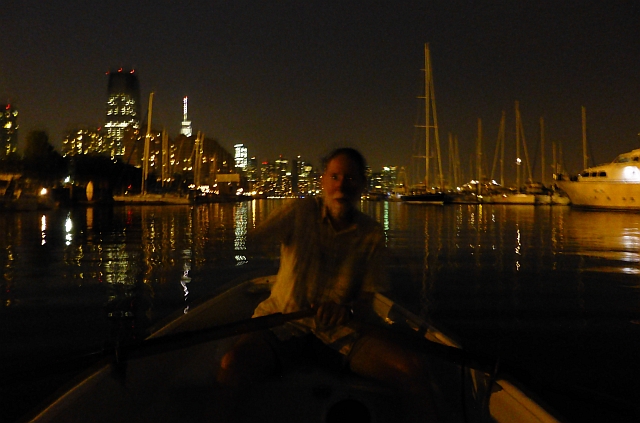
Ferries were coming and going with passengers arriving at Surf City all evening until quite late. The night-time view from the marina was unbelievable.
Sunday July 19 NYC.
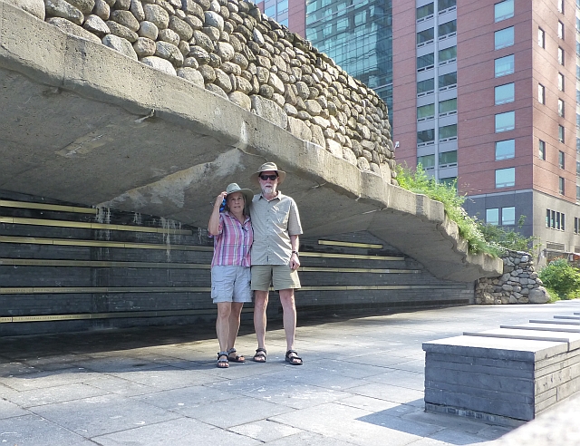
One of the nice things about the marina being at Liberty Landing is that there's a ferry across the Hudson to Manhattan at the latitude of the new World Trade Center. It lands at the Irish Famine memorial at the end of Vesey Street, a compact but quite evocative assembly of historical quotes, ruins, and plantings, culminating in a low vista looking toward the Hudson. We walked off into New York City.
As we approached the New World Trade Center, We walked past a PATH (train to New Jersey) entrance heading underground. In we went (to get a schedule), and with a turn to the right, unexpectedly ended up going through a white marble mausoleum-like tunnel ending under the new World Trade Center (it was so nice and cool and calm and quiet in there, we could have just stayed).
How about that vanishing point? From there it was pretty simple to buy a ticket and take the elevator to the 100th floor observation deck.
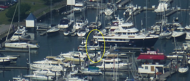
We were able to observe the Hudson where we'd been, the East River, where we were going, the Battery, New York Harbor, the Statue of Liberty, all around. AND, we could see our little "Enetai" across the Harbor in Jersey City.
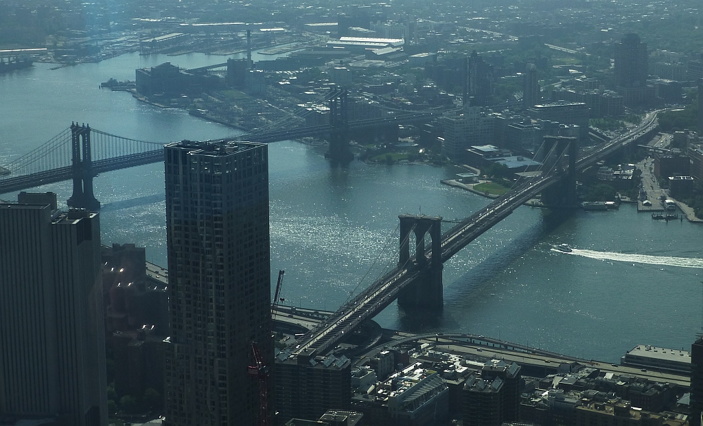
Returning to the hustle and bustle of NYC, the energy in the City was amazing. There was a certain clean new-ness and renewed infrastructure on both sides of the Hudson that possibly was a result of rebuilding after Superstorm Sandy. We walked to the Battery among new plantings and bike lane, and took a tour of Castle Clinton National Monument where immigration was centered prior to Ellis Island (who knew!). We visited the Staten Island ferry building, and headed back to a waterfront restaurant with a patio and had a nice cold beer. It felt like the Mediterranean with the hot wind blowing off the water and vessel traffic, and the outdoor trellis and many languages in the background.
We took the PATH train back to Jersey City and walked a few blocks (Hot! Hot!) to a grocery store. We did our shopping and procured a ride back to the marina from a cheerful immigrant who LOVED Jersey City. He'd made his living for more than 20 years picking up shoppers at the grocery store.
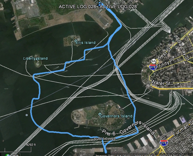
After stowing our groceries, we joined the crazy masses of boats and boaters on the harbor and went out for a sail past the Statue of Liberty (which we had visited in 2000, but for which the line was many blocks long this time), and circumnavigated Governors Island. There was wind for a nice sail, but the waves from the wakes made it seem far windier. Those big orange Staten Island ferries move really fast! We got knocked about a bit getting back in to the narrow channel to the marina ("no wake zone" doesn't seem to mean anything around here).

We spent the last of the evening wandering a bit around liberty landing park, so much activity! The only reference we saw to Sandy: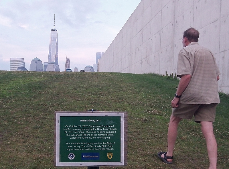
It was still hot, too - but did we mention that the showers at the Liberty Landing marina were air conditioned bliss.
