Enetai - St Lawrence Cruise, 2014


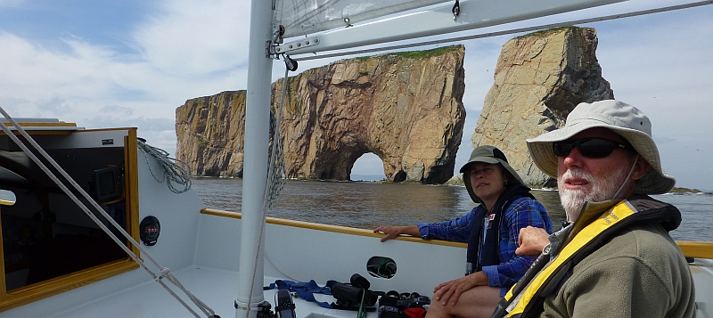
July 17: Gaspé to L'Anse-à-Beaufils. 34nm. We went back to the same restaurant (Café des Artistes) for breakfast. Then groceries and we headed out. We motored down the bay and rounded Pointe Saint-Pierre. Strings of northern gannets flew by at wave-top level. They fly fast and low. We checked out the small harbor of Mal-Bay just around the point. It is crammed with local boats. Probably no room for transients, but they might have allowed mooring along side. Percé Rock and Bonaventure Island came into view in the distance. There were many tour boats taking people out for a close up view. We sailed down on the rock and the island, swiveling our heads and the camera as we passed between them.

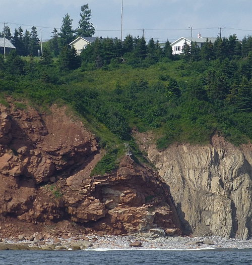
Just beyond Percé are Cap Blanc and Cap Rouge.

The geology was amazingly illustrated here with the contact between the white and red formations showing up in this cliff. There were cliffs everywhere. I would not let kids wander around here!

The wind was up and the waves were smacking the breakwater entrance to L'Anse-à-Beaufils. The breakwater juts out, and you have to make a quick s-turn as the entrance is on the right side of the breakwater.
There was a dredging operation going on in the harbor. We were met at the entrance by a small tug towing a barge out of the harbor. He swung wide to let us past. This tight little harbor was hopping. On the west side there is a marina and a brewery. On the right side, there is a sea-wall and a restaurant (all under the same owner). The tour boats all tie up here on the sea-wall at night. The whole place seems to be owned by a piratical looking fellow, Jacques, who is also the harbormaster. He works out of his car which he drives back and forth across the bridge at the head of the harbor as his business takes him from one side to the other.
The brewery seemed popular and we bought a couple pints and sat on the swings talking to travelers about boats and Percé and Bonaventure. The harbor was being dredged by a backhoe with an extra-long boom that was mounted on a barge. It scooped the muck into a couple of self-dumping barges. The little tug took them one at a time out about a mile and dumped them.
Later, we walked across the little covered bridge at the head of the harbor and checked out the restaurant, and walked up up a network of trails that follow the river inland. There's an extensive set of trails that seem to go a long way. It was getting muddy and we turned back, arriving just in time to buy some pints for the boat from the Pit Caribou Brewery before they closed up for the evening. Facilities at the marina were located in the back of the brewery building. They were a little rough. Some of the plumbing and utilities for the brewery run through the bathroom (that's right - one room (H/F): with an elevated toilet and a shower). You might have to wait in line to take a shower in the morning. This could be a social thing if everyone wasn't bleary-eyed and groggy.
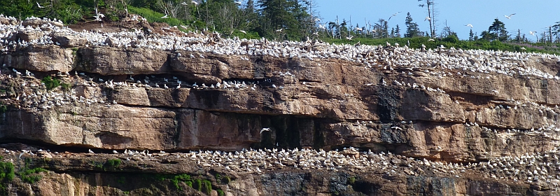
July 18 L'Anse-à-Beaufils to Chandler via Île Bonaventure. 35nm. Feeling that we had not really done justice to Île Bonaventure, we went back the next morning to sail all the way around the island and check out the nesting gannets on the eastern cliffs.
On the way, we saw huge flocks of gannets raining out of the sky into a school of fish.
They must have fast reflexes to get the fish without running into each other with those beaks.
We sailed slowly around the island, fascinated by the birds on the cliffs. 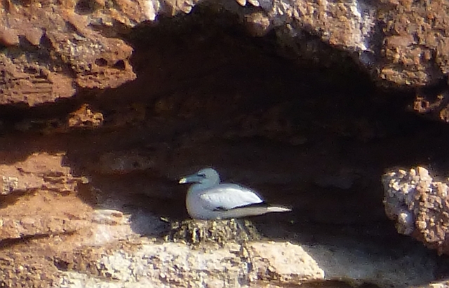


There were seals, too, hauling out on rocks under the cliffs exposed by the receding tide.
As we came around the island, we set a course for Cap d'Espoir. We had a fair wind at first but as we approached the cape, the wind went around to the west and freshened. We tacked up to a small sandy harbor just under the Cape and anchored. While the wind blew over our heads we ate lunch and watched gannets dive for fish and pop up out of the water either with a fish or not. After a couple of hours, the wind died off and we headed out under power. The wind may have been gone but it left a nasty lump. We pounded our way through while it slowly dissipated.
Chandler is a strange place. There used to be a ferry here that crossed Baie des Chaleurs but it had ceased operations. The marina was half empty. There were a couple of boats from Quebec that seemed to be here for the summer. One older couple acted for the marina, directing us to a slip. When it became obvious that the 'harbormaster' wasn't going to come, they kindly lent us a key for the marina building so we could take showers. The bathrooms are modern and well kept. There's a restaurant upstairs that seems to be not associated with the marina. There is a chest freezer in the marina office. They don't sell ice but you are invited to put your own water bottles in to freeze overnight. We called the harbormaster on the phone and expected him to come down and take our money. In the meantime, we walked into town past a little train station. The town had put in a short railway line to transport tourists from the ferry dock into the town center. The self-propelled passenger car sat on the rails near the marina with bushes growing around it.
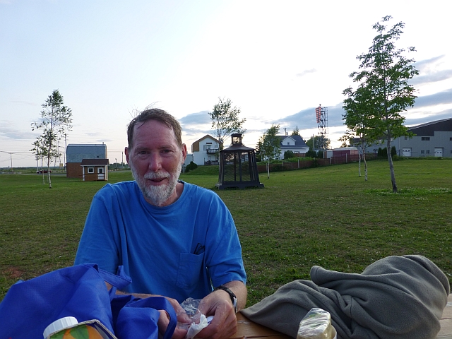
Chandler has a nice grocery store. We bought a variety of sandwiches and salads and walked back to a grassy park to eat dinner at a picnic table. At dusk we walked out on the very substantial ferry pier. It seemed like the whole town was out fishing on the pier in this fine weather. At the end of the pier a teenage girl was catching mackerel at a rapid rate. She flicked them off the hook onto the pavement behind her, not wasting time with a bucket. A ~5 year old boy was throwing gravel off the pier into the water. He was trying to get attention by running right up to the edge as he threw the gravel. The water was 10-15 feet down. His family studiously ignored him but they must have been thinking how they were going to save him if he misjudged and went over the edge. We got the hell out of there because we sure didn't have a plan.
We had to call the harbormaster on the phone again- basically insisting that we needed to pay for our moorage, and finally he come down and took our money after 10 PM.

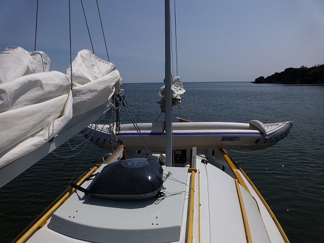
July 19, Chandler to Paspébiac, 34 miles. No wind. We set out up the Baie des Chaleurs. We anchored in a rocky cove at Pointe au Maquereaux in the late morning. For only the second time this trip, we pumped up our inflatable kayak and paddled ashore.
We seemed to be in a park. We walked up along a network of trails to the point where there was an observation deck built out over the rocks. A grand vista, indeed.

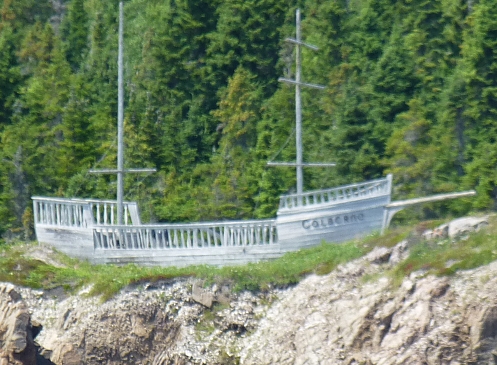
Even out at the viewing platform, which seemed old and deserted, there were recycling bins! This was true pretty much everywhere in Canada, but to find them here was a bit astounding. As always, the trail went on far longer than we could explore, and we turned back. Such a gorgeous Saturday and no one was out sailing in this lovely bay. From the viewing platform, we did see a few people along the shore by a small house, but no sail nor motor boats enjoying the day. There was also this fanciful structure on a bluff
We moved on past Port Daniel to the town of Paspébiac. Here, there were a few motorboats outside of the marina, which itself was crowded and lively compared to all the others on this trip. The marina had the first boat we'd ever seen with a boat name that was in text shorthand: "lol ;-)". A fellow on the dock greeted us in English. There was a row of sailboats there that he said all belong to English speaking 'Loyalists' .... ? Loyalists, from the American Revolution? Yes, there are quite a few in Paspépiac. Wow, that is 240 years of cultural identification! (I guess it must the same for the Cajuns in Louisiana). There was a picnic going on that included some good natured French/English badinage. There was a noisy bar on the 2nd floor, with good music later, which closed up at a reasonable hour.

We walked up a long straight road to the town on top of a the bluff. To the east of town, we came upon a brand new cultural center with a bold stainless steel sculpture out front.
Paspébiac has a replica historic village on the waterfront near the marina. A restaurant, L'Ancre, operates in one of the buildings and was highly recommended at the marina. They were booked up with reservations but after a short wait, we were able to get a table in the back. BYOB, but the food was pretty good- yet I think the main attraction is the historic ambiance.
Paspébiac has a commercial fishing harbor next to the marina. There was a mound of crushed ice next to a fish processing plant. It was just melting on the ground so we took a bucket full back to the boat for our cooler (don't worry, we didn't ice our drinks with it!).

At Paspébiac we met someone who'd seen us at Chandler, who explained le Corridor Bleu which he was taking advantage of. We'd seen the logo and some outreach materials, but hadn't understood that it's a consortium of marinas all of which exchange dockage. I may not have this right, but my understanding is that if you belong to a member marina in the Gaspé-Magdalen Islands Region-specifically the Baie des Chaleurs and Gulf of St. Lawrence, you can get a slip at any of the members. It was set up to encourage people to travel more and visit other communities. "La Mer, La Riviere, La Culture", there are certainly many beautiful places to visit along le corridor. [http://corridorbleu.com/en/naviguate-en/a-propos-en.html ]
July 20, Paspébiac Quebec to Caraquet New Brunswick, 20nm Changed to Atlantic Time in the middle of Baie des Chaleurs from Quebec province to New Brunswick. We were served a delightful compliment of having the best boat of the year to visit Paspébiac as we left to cross Bay Chaleur. We had a nice wind and made it across in good time, sailing around a bird-covered sand bar and anchoring in the afternoon behind Caraquet Island. The place was crowded with motorboats recreating. Finally, we saw where everybody was! We were a little uncomfortable in all the wakes. At dinner time they all went home. All except one worm in a largish Clorox bottle who decided to take one last tour of the anchorage at dusk with his bow pitched up and his stern dragging to throw the biggest possible wake. I can never figure out whether these people are psychopathic or just oblivious, but this one's trajectory seemed rather targeted. We had a nice swim, and Gina was absolutely delighted to finally have a night at anchor, enjoying the natural setting.
July 21, Caraquet to Shippagan, 15nm. We sailed all the way to Shippagan (pronounced very fast with the accent in the middle shhhPAHgn), following the well buoyed channel. Shallow water on all sides. We have a shallow draft boat but that does not mean we should go charging across an unfamiliar sand flat at full speed.
We loved Shippagan! There is a substantial fishing port here. The marina is small and behind a breakwater with small navigation aids which seemed to confuse some people. There is also an aquarium right near the marina, and a restaurant - and the marina′s facilities are along the hallway between an events center and the restaurant. The fishing harbor is larger and south of the marina. It seemed to be the off season for fishing. The fishing boats were all up on blocks in a large paved storage yard. They were all extremely well kept and in fresh paint of all colors.

There were large stacks of crab traps tucked here and there along the waterfront.
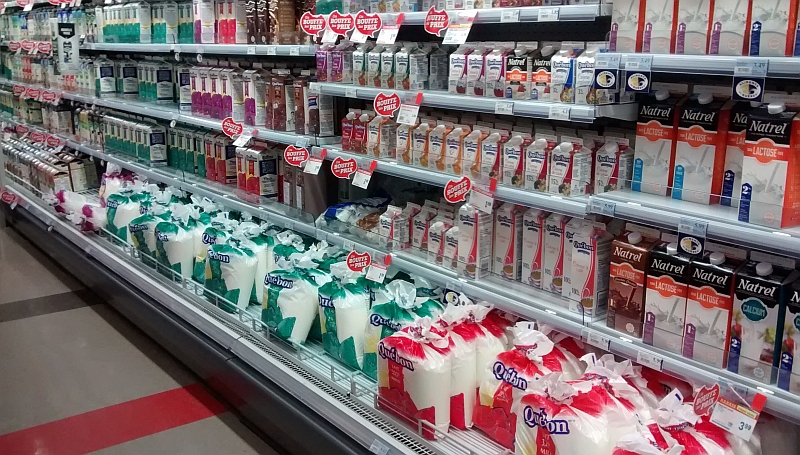
The town is well-appointed with a satellite campus of the University of Moncton not far from the marina and a hardware store in town that has marine supplies and charts, as well as sailing directions. The grocery store is nearby and well stocked. Canadians buy their milk in bags. How do they pour it? A mystery.
The marina manager was very helpful, and jumped in his truck right away to take Bo to the gas station with his jerry can(s). Only they actually HAD gas at the docks. He thought we needed diesel instead of gasoline (essense). A miscommunication.
A 2km boardwalk (Sentier Rivage) was wide and inviting with several gazebos spaced along it where walkers can sit and rest. It extends along the water′s edge to the north. 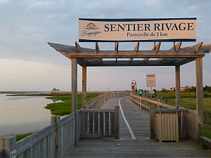
July 22-23, Shippagan. Winds were still approaching gale-force so we holed up in Shippagan to wait out the weather. They sure could use some of those free bikes at the marina! We did a lot of walking.  The marshes in the area have a fantastic assortment of birds, there's a cute seal show at the aquarium with many references to 'les phoques' (and also in English, the seals) which can be quite startling to the ear for speakers of English. The aquarium also had an explanation of the oddities of the tides in the Gulf of St. Lawrence explaining the nodes near Iles de la Madeleines. Tides get a little strange further south along New Brunswick, influenced by flows from two channels from the Atlantic (northern flows through the Strait of Belle Isle between the northern tip of Newfoundland and Labrador, and more southern and wider Cabot Strait in the east between Nova Scotia and Newfoundland). We got to experience how these tides vary from the usual, further down the coast of New Brunswick.
Each evening we walked along the boardwalk - you have to time this right because the mosquitoes come out from the marshes and attack if you're still out there after the sun disappears.
It was exceptionally hot (the temperatures for the entire voyage were much hotter than we had expected, we rarely used any of the warmer clothing we'd brought) and even putting our feet in a bucket of water to cool off sore feet! The breakwater surrounding the marina protected us from the wind, but also any breeze.

Also in Shippagan, where the marina sold shaved ice rather than blocks or cubes (and too much to fit in our cooler, being mainly for the large coolers of the recreational fishermen), we took to having sangria with shaved ice at the end of the day, which is both cooling and relaxing. One of those fishing boats in the marina gave us some mackerel at the end of one day, and we had a delicious fresh mackerel dinner cooked up on our little stove.
At the visitors' center we discovered that there is no public transportation available at Shippagan, not even a taxi (well, the taxi was reportedly in the garage). We arranged an auto tour around to Caraquet for lunch. We had a great 'tour guide', "MiAnne"(not sure how that is spelled) who provided history, and good conversation. Part of the "history" resulted from an innocent question Gina asked. We learned a little bit about the Acadians and the Québécois, one major distinction being that the Acadians were the first French speaking people of Canada.

As we planned to continue on, we tried to get some information about getting in to some of the sandy inlets along the shore of the Gulf of St. Lawrence, but we couldn't get hold of anyone to provide the local knowledge the guide said was needed. We were to find out that the sands shift quite a bit and that the recommended 'local' knowledge was probably pretty important for some of the shallow options we would pass by. Instead we were off for another long day.
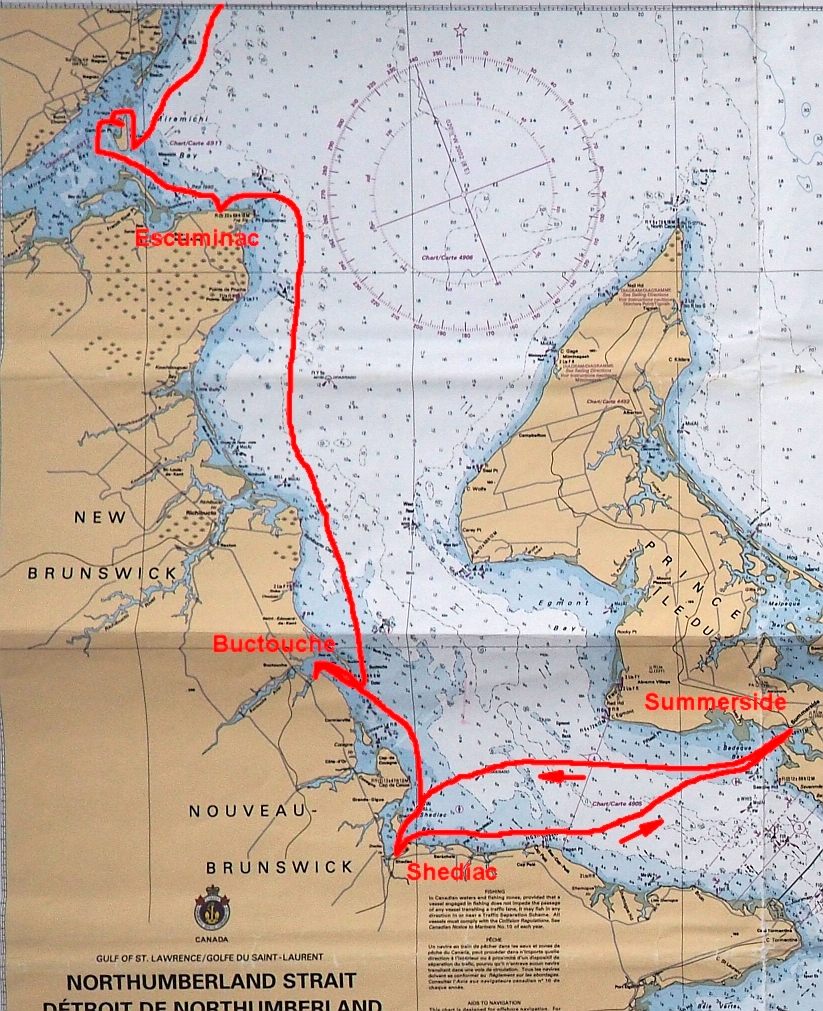
July 24, Shippagan to Escuminac (via Portage Island) 60nm. We headed out early to catch the tide through The Gully and out into the Gulf of St Lawrence. On the south side of The Gully is a basin mostly used by fishing boats. It is enclosed by rusted out sheet-piling.

We turned right and headed on down the beach. Some motoring, some sailing. Arrived at Miramichi Bay about 4:00 PM. Our intention was to anchor behind Portage Island as we'd read that it was a good anchorage and Gina especially was missing the anchorages of Maine. The channel must have shifted recently, it was way different than the chart. We almost ran on a sandbar trying to get into the former channel that passes north of the island.

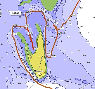
This was ridiculous. First we had to go to the south end of the island to pick up the channel. Then we had to feel our way up the channel back up to the north end of the island, go around the end of one cresent tip of the island and back down the back side of the crescent along the island shore to anchor in the shallows between the 'arms' of the island. We were not happy when we got there. It was quite shallow, and to get any kind of shelter, we had to tuck way in. The bottom was grassy, there were greenhead flies and the island was flat, offering little protection from the wind- not very attractive. We took half an hour to confirm to ourselves that this was a lousy anchorage before we pulled up the anchor and headed to Escuminac.
This time we motored up the other crescent 'arm' and around the bay side of the island. In a 60 mile day, we wasted three hours and 12nm fooling around with Portage Island. Maybe we would have appreciated it more if we weren't trying to find a secure anchorage. We went around the south end of Portage Island and picked up the channel to Escuminac.
We moved on to the fishermans’ harbor basin at Escuminac which we'd read about as a place to tie up. It’s, on the south shore of Miramichi Bay about 3 nm in from the point. There are actually two basins at Escuminac, fishermen on a breakwater directed us to the more inland of the two. We ended up coming in right behind a very large sailboat that had come from the south around the point. Their keel stuck in the entrance. They had to back out and go somewhere else. Anywhere is fine to tie to the wall. The harbor is basically made out of a concrete wall. There are metal ladders set in the wall to climb out. No floats. Very protected. We climbed up the wall and had a look around. Not much there except a fish-and-chip place that is reported to be “to-die-for”. They were closed. I guess people eat dinner early in Escuminac. The restaurant opens at 7 for breakfast. No other food in sight. We walked along the road, out towards the point. There′s a big caravan park (camping) along the water. There was a large house that had an enclosed yard. The yard between the house and the garage was under glass, maybe a few thousand square feet? That is a bold concept!
The weekend was going to be lively as a tent and hay bales were set up for a dance.
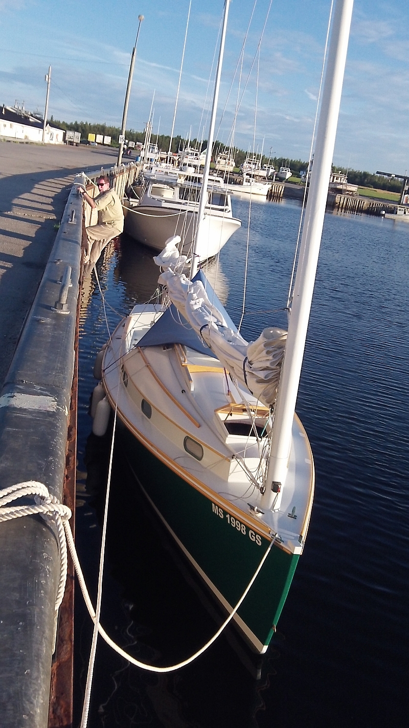
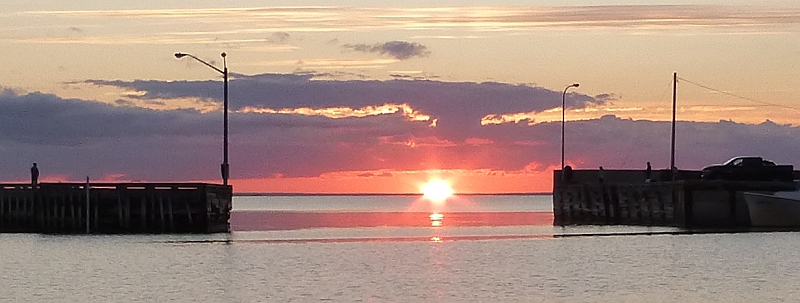
As we ate dinner back on the boat, we discovered that we happened to have tied up so that the sun set spectacularly, centered right in the opening to the basin, between the walls framing the harbor entrance across from Enetai. We had a prime seat to a gorgeous view. We were disappointed that Portage Island hadn′t worked out but Escuminac was a nice alternative.
July 25, Escuminac to Buctouche, 40nm. We rounded Escuminac Point in a chilly fog and headed on down the coast, mostly motoring in the light wind. The weather cleared, and we saw some pleasure boats, sailboats off Richibuctou and a few motorboats. Everything was quite flat, very calm. We saw the dunes off Buctouche, with a long sand spit (7 miles long!) creating the harbor of Buctouche. We stopped and anchored off the outside of the spit expecting warm water, and waded around the boat. The bottom was sandy and had several bars, like an ocean beach, but the water was really cold and we felt a little exposed so we promised ourselves we would swim once we got around to the inside. It took forever to round the tip and get into the estuary. But then we found the inside 'hook' of the sand spit to be too mucky and grassy for swimming, so we continued into the estuary. Rather than going all the way in to Buctouche, we anchored in a wide shallow area under a bluff.
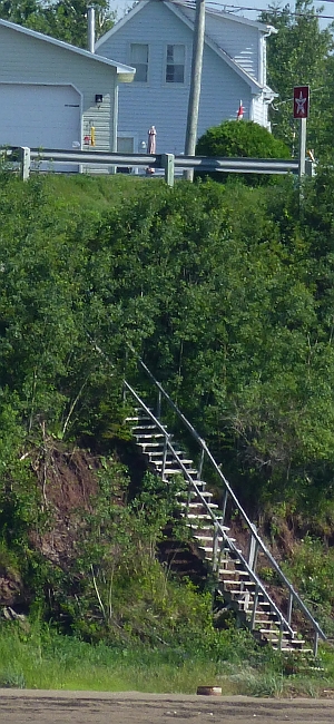
After dinner we launched the inflatable kayak and paddled into shore for a look around. There was a very rickety flight of wooden stairs up the bluff. We crept up the stairs and gained the road at the top. The stairway was marked “private” at the top, but how were we supposed to know having approached from the beach?
It was too far to walk to town but we had a nice stroll along the top of the bluff. We heard later the town had a nice dock that was donated by the Irving company.
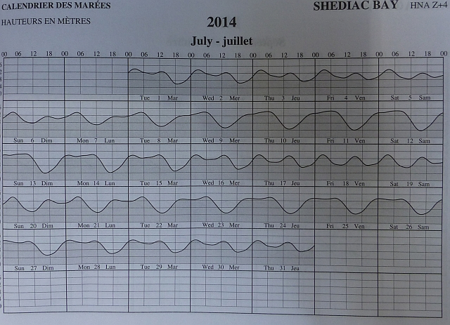
July 26 Buctouche to Shediac, 23nm. We continued down the coast, seeing a few pleasure boats out sailing, and lots of sandy beach. Here's where we really saw the strange tides . When high, they stay high for a while, likewise for low tide, and then there's a lot of shallows, although tide range is only about 2-3 feet average. The tide book is really helpful and necessary if you're going to sail near the coast or in the harbor.
At Shediac harbor, Point de Chene is a busy marina with an active tourist wharf. Further in is Shediac yacht club, which is quite large, with nice facilities staffed 24 hours a day. The harbor has an island, and except for the tides, might be a place to anchor, but local knowledge would probably be key and we didn't see any boats at anchor. Many boats in Shediac Bay were not following the buoys either. But here, finally, we saw Canadians recreating in large numbers! This beach at Shediac was almost crowded!

Point de Chene was really touristy, so we went on to Shediac Yacht Club. It's a U-turn at the very end of the breakwater to get in. Call ahead on 68 and they'll tell you the dock and be there to catch your lines. Showers, restrooms, laundry, a really nice facility. They are a little wary of transients - for example this is the only place we were asked for proof of liability insurance. Fortunately we were able to download a copy of our policy. They also require marine-grade power cords. Our extension cord we use to charge our battery was not allowed. They are more of a yacht club than marina. Michael, who runs the place, was very helpful. Little did we know how much time we would spend here.
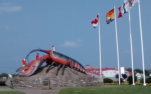
Shediac is famous for the giant 28' lobster at the information center in town (at the highway entrance to town).
While there are several larger grocery stores beyond the lobster, they're a bit far from the marina. But, it was an easy walk (~10 min) to two in-town grocery options, and also restaurants, and the downtown where there's a farmers market on the weekend. It's a longer walk (on a nice bike path) to the Point de Chene tourist area and restaurants. We found out upon our return to the yacht club that free bikes are available at the marina, and there's a nice bike path to Point du Chene and Parlee Beaches. Everybody here seemed to be bi-lingual. We had noticed as we moved 'down' the coast (south) that more English was spoken. Shediac seemed to have a perfect balance of, and tolerance for, French and English.
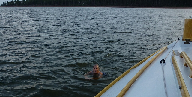
July 27, Shediac New Brunswick to Summerside PEI. 37nm. We started out with a nice breeze. It quickly built to 20-25 knots and started to give us trouble. We reefed down and headed more in an along-shore direction to get up under the lee of Bas-Cap-Pelé. We idled along here and ate lunch. There were many many people enjoying a beautiful weekend day at the beach. There seem to be miles of shallow sandy beach. As we cleared the cape, we had a better angle on the wind and headed on a broad reach to Summerside. We anchored off Holden Island and went for a swim before dinner. Delightful, as long as you watch the currents! Overnight, the wind picked up more and blew like snot from the North. Good thing we have reliable ground tackle.
July 28-29, Summerside. We had been to Summerside in 2009. It was really neat to connect with the western-most point of our previous travels. It's a really pretty town, much as we remembered it. The Silver Fox Yacht Club and Curling Club is a very nice facility with all amenities, restaurant and bar, laundry area with a couch, and washrooms with a shower. It's a short walk along the waterfront to an area of tourist shops and a museum with a large information center at one end (this was new since 2009). The information center made every effort to be helpful, we'd wanted to rent a car, but none were available. We got information on the bus to Charlottetown that leaves from a stop close to the marina.
The strange waterfront bridge linking to the boardwalk, that we'd seen and marveled at in 2009 is still there, looking good 5 years later.

We walked all over town, and continued along and out of town on a rail-trail that passed by a park. We circled around and came back into town past all the big-boxes at the top of the hill. Hot and thirsty, we stopped in an A&W for a rootbeer float. Isn't this the drink they built the company on??? Well it was definitely out of style at this franchise! The vanilla ice cream was in the form of a pellet that the waitress poured root beer over. Nonetheless, it was quite refreshing, and just what we'd needed - despite a surfeit of strong winds, the weather was exceptionally hot.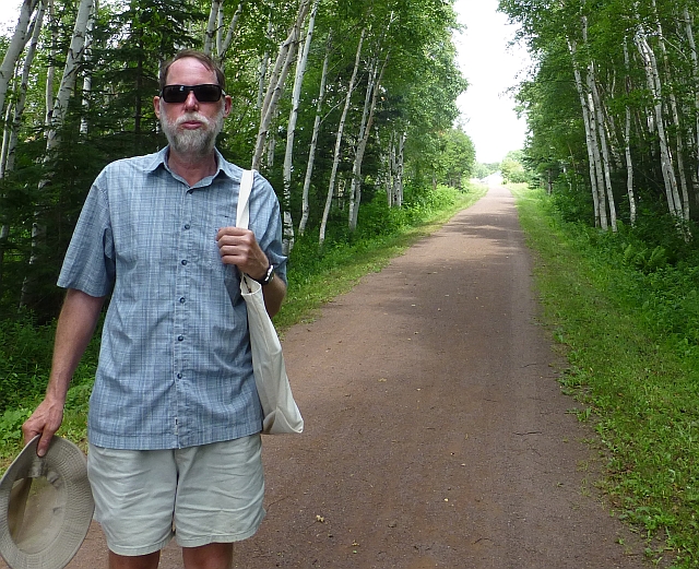
A most exciting circumstance happened serendipitously. There´s a boardwalk from the marina toward the east along the harbor, ending in a viewing platform one flight up. As we approached it at the end of one of our walks, an eagle flew right in front of our eyes, and continued along the shore until it was out of sight. It was so very close!
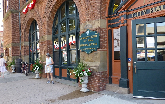
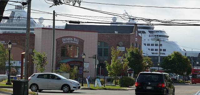
The next day we took a bus to Charlottetown using the bus schedule we'd gotten from the Info Center. The reason we'd tried to rent a car was that Gina wanted to see the wind turbines up close along the northeast shore. The docent at the info center had called three places in town and only one of them said they had a car available on short notice, but when they went out to look for it, they reported back that they couldn't find it and offered a pick up truck at a high price. Hmmm. (Did we mention that PEI is a small island with narrow roads?). This had taken quite some time, and finally the docent had offered to rent us his car, but we declined.
At this point in our trip (we had a week of vacation left) we began to wonder where we were going to end the trip and pull out. We were 5 weeks into a planned 6 week trip. If we continued East into Nova Scotia, we would have to travel that much further to get home to get our trailer, then drive it back to get the boat, then drive home with the rig. Every sailing mile would thus require 3 driving miles. One possibility would be to go as far as Tatamagouche, where we began and ended our 2009 cruise of PEI. But how to get home? We would have to hire a cab to the airport in Moncton, then fly home via Toronto, or Halifax to Boston. Pretty pricey and a crazy bit of traveling.
Well, the decision was made for us when we got a text from our daughter (from the study institute in Uganda): "I fell and broke my wrist, but don’t worry". Over a couple of days it became apparent that we should, indeed, worry: the wrist would need surgery and she should come home to the Boston area where we have really excellent specialists for this type of surgery. We decided to head back to Shediac where we had the best transportation options.
July 30, back to Shediac, 35nm. As we left the marina we were a bit worried as the winds didn´t seem to have abated, but soon we were motoring. Conditions had gone from too much wind, to Light winds.

July 31, Shediac. Shediac Yacht Club found us a slip, however it was at the outlet end of the marina where the terns battle and leave droppings on the boats, oh well. The marina staff let us set up in an empty room where we could call and text with program leaders in Uganda and Chicago and doctors in Boston, using every one of our communication devices, sometimes at the same time, for hours, to arrange to fly our daughter home and arrange for a surgeon and for surgery and to arrange to get our pick up to bring Enetai home. We had to provide a 24-hour advance notice to get a bus from Shediac, it's a flag stop on the route to Moncton. So this is when we had an opportunity later in the afternoon to borrow bikes and explore further along the bike path all the way to Parlee beach. It’s a wonderful spot, especially when approached by bike! Thank you Shediac Yacht Club!
August 1, End of our 2014 Sailing adventure. Bus to Moncton, bus to St. John, cab to the border in St Stephen. Our friend Russ very kindly picked us up at the border and drove us home.
August 2, Head out at 5:00 AM. Make it back to Shediac late afternoon, pull boat out at ramp and travel back across the border to Calais, Maine after trying to find a place to stop and sleep along the highway south of St. John, weekends are busy at the hotels and motels.
August 3, Drive home, safe and sound!.
