Enetai - St Lawrence Cruise, 2014
Part 2: July 5 to July 17, Quebec City to Gaspé, 406 nautical miles
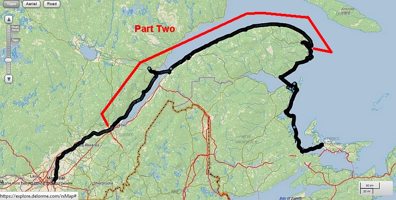
NOTE: After the basin at Quebec, which has a lock to avoid most of the tidal variation, we found that the boat basins along the shores of the Saint Lawrence are mostly behind constructed breakwaters, made of enormous L-shaped walls of riprap, no natural harbors or coves. Even so, a number of them dry out at low tide.
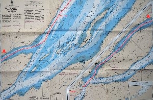
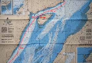
July 5: Quebec City to Île aux Coudres, 51nm
Leaving Basin St. Louise, we decided to follow the North Channel heading from Quebec to Tadoussac at the mouth of the Saguenay. Tadoussac is 110 miles distant, necessitating a stop (we were aiming for Cap-á-l'Aigle - a "harbor of refuge" at 72 miles). I'm not sure we planned this too well; we played the tides right but the wind was light from the east.

As we came out into the open from behind Île d'Orléans, the wind picked up on the nose. Wind over current kicked up a short chop that made for a slow uncomfortable ride. Somewhere along here we lost the top batten in our mizzen sail. Mid afternoon the tide changed. We jolted through a vicious tide rip and several-foot swells as we pushed against the flood approaching Île aux Coudres.
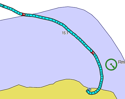
We were worn out, saw a 'Mouillage' (French for anchorage) shown on the chart, and decided to anchor off the island near the ferry landing to wait out the tide change. There is an unstaffed 'marina' of sorts there but it is filled with mud at low tide. Enetai usually rides to a wind rode but the currents swirled through the anchorage and she would not settle down. (We were told later that mouillage is actually for ships to anchor and wait out the tide. That makes sense because, while tucked in a curve of Île aux Coudres, this wasn't much of an anchorage - it was pretty open). We swung between current and wind the whole time we were there, you can see the track we made, below.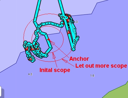
July 6: Île aux Coudres to Tadoussac, 59nm
We slept fitfully until waking at 4:00 AM to catch the ebbing tide and we headed out at 4:30. The sunrise was beautiful!
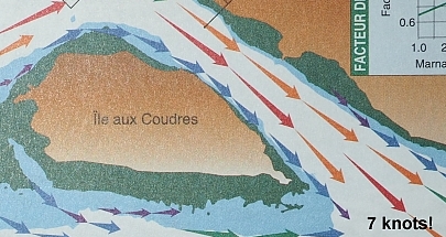
We made as much as 12 knots over the ground as we approached Cap-á-l'Aigle. The current atlas shows the dramatic lift you can get when you play the currents right.
We pulled in at 7:00 AM, and waited at the fuel dock for the office to open. 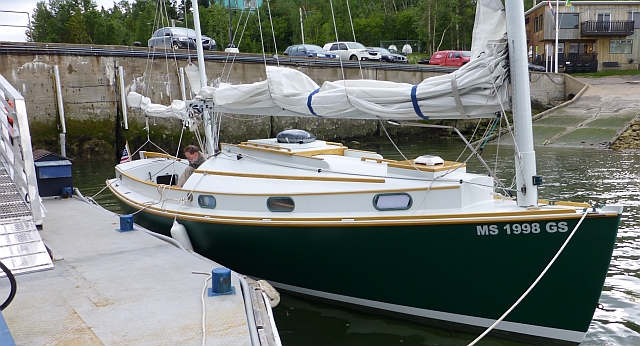 Half an hour later a woman came down and sold us some gas. She spoke no English but we seemed to complete the transaction without any trouble. The tide was flooding at this point so we asked about waiting and moved over to the transient dock to wait it out. This is where we had a misinterpretation and later difficulty with the "Harbor of Refuge" and lack of English.
Unaware of the issue, we made our way to the Saguenay and as we approached the mouth of the fjord, we saw first one, the another, and another and more Belugas heading toward us. We hurriedly turned off the motor and started to drift, never realizing that they were actually converging directly on us to check out the new boat. A group of at least a dozen whales, adults (white) and young ones (light gray) came right up to Enetai and eyed her and went under her and along our port side. While Gina took a video of them, I got busy pulling up the centerboard, motor and rudder so they, and we, wouldn't get hurt. And then just as quickly they disappeared! It was a fantastic experience.
We turned the motor back on and crossed the mouth into Tadoussac Harbor. We anchored out off the beach and had a peaceful night.
July 7: Saguenay River
In the morning we ventured up the Saguenay fjord with a drizzle on the incoming tide. As soon as we got around the corner from Tadoussac, we were greeted by a pod of Belugas! They converged on us, nine or ten of them. Another pod of Belugas greeted us a little further up. The water is very cold here, about 43F, due to upwelling from the bottom of the fjord. The whales like it because it brings up nutrients. They don't seem to mind the cold, but the centerboard case was sweating and dripping onto the floor of the cabin.
After about an hour I got a little nervous that we could get trapped up the fjord by the wind. I convinced Gina that we should turn around. The Fjord goes 60 miles inland. There is a ferry crossing at the mouth which wasn't any trouble on our way in. As we approached again, a fog bank moved in. I broadcast a "securite" to the ferries as we crossed their route. They did not acknowledge but neither did they hit us. We took a slip in the marina this time. The dock hand measured the boat instead of taking my word for her length. We negotiated that he would only count half the rudder if we kept it swung to the side. I could have dismounted it but paid a couple extra dollars, instead. The boat is a "26 foot Norwalk Islands Sharpie" so we have always given her length as 26' when paying for dockage. I am prepared to remove the rudder if her length comes into question. This was the first time it ever has.
Tadoussac is a very nice tourist town, with a big hotel centered on the harbor above the beach, historic displays as well as a museum with information on the belugas, and many crossiers (whale watcher boats), little cafes and restaurants, groceries, and some hiking trails. Again, recycle bins were located wherever there was a trash bin. We enjoyed walking around and exploring and having a nice meal at one of the restaurants.


July 8: Tadoussac to Trois Pistoles, on to Anse à l'Orignal, Parc National du Bic 48nm
In the early AM we set out to cross the St. Lawrence to Trois Pistoles in a complete fog, we could barely see the other boats on the dock as we left. 
We paid very close attention to the current charts. The current charts use arrows to show the current: the color and size of the arrows indicate the strength of the currents according to the stage of the tide. This area is marked with large arrows swerving in different directions for most stages of the tide.
Trois Pistoles has plenty of dock space, but the marina dries out at low tide. Not a problem for our boat, but the real problem is that when the marina is dry you can't leave. We crept around behind the ferry landing to the marina. There were no services or facilities at the marina. We walked up the road a little ways. There was a really nice path and recycling bins, ready for people to stroll and enjoy the place. The town looked pretty far away. The ferry offices, a few blocks from the marina were no help at all, except to tell us to call the mayor, M. Rioux. We left a voicemail but weren't sure what the outgoing message had said as it was in french. It wasn't clear as to why the town's not near the water? There didn't seem to be much to see or do, and rather than dry out on the mud, we decided to leave while the leaving was good. As we got back to the marina, a very nice man running a tour boat 'Jean Rioux Bateau', landed on the dock and offered for us to stay if we wanted; we think he was the mayor, but we were ready to go. Since the wind had the boat pinned to the dock, we ended up having to warp our way out of the marina. Awkward!
We took the ebb on down the shore. The wind was building from the West. We rounded Cap Enrage and took shelter in Anse à l'Orignal. We anchored as close to the rock studded beach as we dared. The wind blew harder and harder all that night and the next day. We set our mizzen with two reefs as an anchor sail as is our custom not noticing that with the top batten missing, the leach was fluttering destructively. There were three other boats further out in the harbor also trying to stay out of the wind.

July 9: Anse à l'Orignal to Rimouski, 16nm
We were windbound. The scenery was beautiful in the bright sun. The wind blew a piece of kelp up our anchor rode. It was laying on the side deck when we got up in the morning like some sea monster flapping away outside the window. 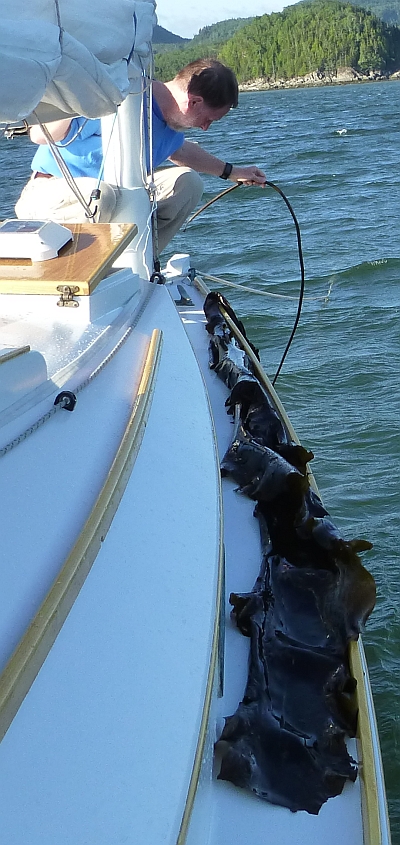 At some point we noticed the damaged mizzen and took it down. We taped up the leach with a roll of sail repair tape that we have carried for 30 years and never used. The adhesive was still good! Gina stitched it by hand to be sure. Even at anchor, the wind was overpowering. I had to be very careful letting out more scope; never letting the rode off the cleat for fear that it would get away from me. We kept listening to the weather radio, which predicted a lessening of the wind around 8 PM.
So, about 8:00 PM the wind moderated a little - or so we imagined. We decided to make a run for Rimouski. We sailed down the coast with just the mizzen up in about 25 knots of wind. This was our first night-sailing of the trip. We used the GPS to avoid the offshore island and find the first channel buoy against the shore lights. With Gina on the GPS and me picking out each buoy in turn, we motored down the channel to Marina de Rimouski. We came in about midnight. Fortunately, there was a group of people on the end of the dock to catch our lines; I botched the approach in the crosswind but they fended us off. This became a recurrent theme.
July 10-11 Rimouski
By this point we'd been in some pretty rough stuff, foul weather gear was de rigeur. The wind has been overpowering and at Anse à L'Orignal had torn the mizzen sail. Gina said we had to take some time off at Rimouski to recover.
The marina at Rimouski is well-appointed, with many docks, lots of activity, and even a very nice restaurant upstairs. It's quite a ways to town, but fortunately, the marina has free bicycles. Helmets too. And, there's a nice bike path along the St. Lawrence to get into town. At the east end of town is a large park, with bike trails along both sides of a stream. This makes for a wonderful bike ride.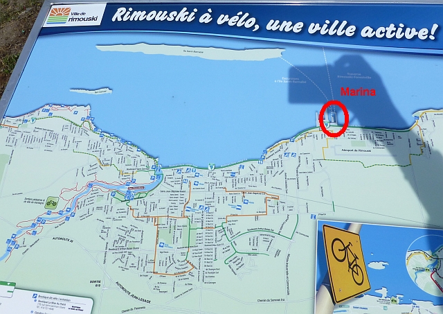

One of the guys that helped us land our boat offered to help us get our sail sewn. The next day he took us to a canvas shop and they took the sail and fixed it on their big sewing machine, with Renè translating what we needed. He also took us to the grocery store, and we dubbed him the Mayor of Marina Rimouski.
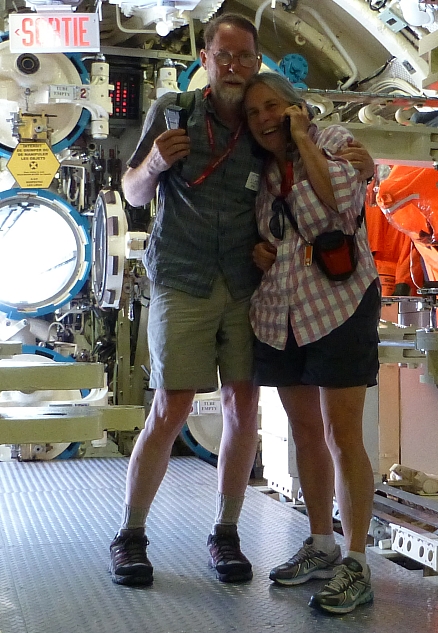
A different day, we rode the bikes to Pointe au Père and the lighthouse (phare), the submarine Onondaga, and the museum to the Empress of Ireland there. Pointe au Père is noteworthy for being the nearest town to the site of the sinking of the Empress of Ireland, the Canadian Pacific ocean liner that went down on May 28 1914 after a collision with another ship. The lighthouse was visible for most of the bike trail along the waterway, which was wonderful. The tour of the Onondaga was excellent. 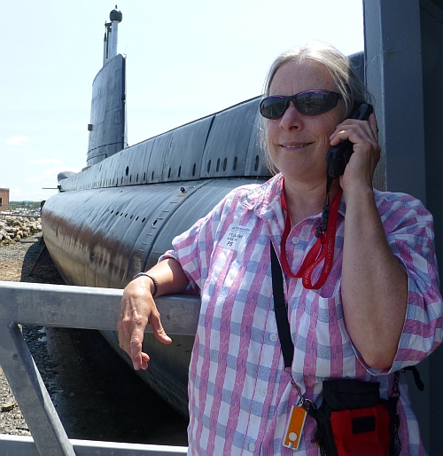
 We had passed along the way a sculpture shaped like a globe, held up by hands. On the way back, someone was cleaning it as we stopped. It was the sculptor himself, L'artiste André Gamache "The Millenial Tree: Vision of the Past, the Present and the Future". Returning to the marina, we had dinner at the marina restaurant.
July 12, Rimouski to Metane, 47nm.
Again, we left early in the AM, with quite a distance to travel (for us that is: considering our little boat and how fast she can travel) to the next available 'harbor', resulting in half motoring, half sailing. The thing is, you get out there, you know the next harbor is 40 miles away. We felt like we'd had it clearly demonstrated that it would be irresponsible to dawdle. There's no harbor along the shore until the next one, so you end up motor sailing in light winds. From Rimouski on, for most of the rest of the trip, we felt the need to get from one sheltered harbor to the next expeditiously. Past Rimouski, the tidal currents diminished and we could not play the tides to boost our speed over the ground.
The Club de yacht de Metane is off the river at Metane, entered between two long jetties. The marina is a dug basin on the east side of the river, before the bridge. Someone wrote that they anchored here but I can't see how they had room to swing. We paid for a slip. The marina has a few people living aboard their sailboats for the summer. They seemed a little put out by having us show up in their midst. The facilities are excellent. The free showers seemed quite new, maybe that's why you are requested to squeegee them after you shower.
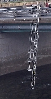
We walked over the bridge over the river and around town. We walked up the Promenade des Capitanes which follows the river on the west side of the river. There were signs for a fish ladder ahead. And there we were, at a ladder that lead from the middle of the bridge, down to the river bed. Is this it? No, this is a fisherMAN ladder. Really. The ladder provides access to the river bed from the middle of the bridge for fishermen in their waders. And there were, indeed, fishermen fishing in the river. The real fish ladder leads from the river past the dam upstream of the bridge and next to building.
There are a lot of empty parks and civic works. The town seemed to be lightly inhabited. We were looking for dinner. We found one hopping pub. I think everybody in town was in there (Saturday). We didn't even try to get in. Instead, we got some takeout and a bottle of wine at the grocery store and had a very nice picnic back at a park along the shore, across the road from the marina. There was a party on the beach, maybe a family get-together. We watched a couple of guys hook about 5 extension cords together to get power out to the beach for their stereo system. We thought they might keep us up with their music but they packed up at dusk.
July 13, Metane to Sainte-Anne-des-Monts, 47nm.
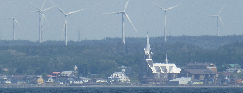
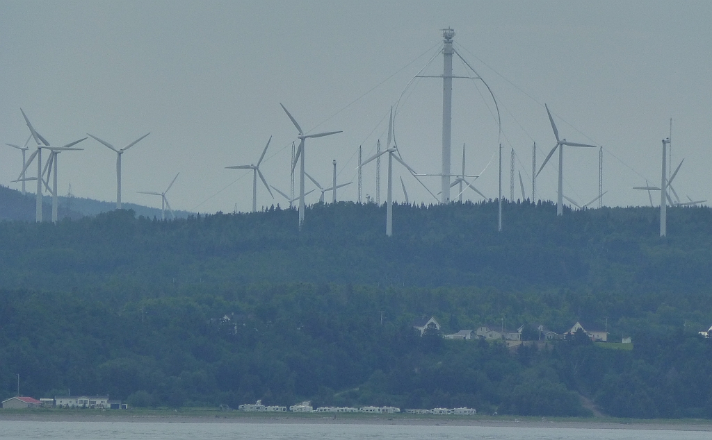
Leaving at 5:30 am to catch what tide there was going from Metane to Sainte-Anne-des-Monts. We motored most of the way. At this point, we've learned that no wind is better than too much wind. We passed Cap-Chat, with its lighthouse and extensive wind farms. Besides the cape itself, the Darrieus Wind turbine is a prominent feature among the many conventional turbines.

There were lots of boats in the little harbor at St. Anne des Monts, a mix of pleasure boats and fishing boats. All friendly. The marina docks are adjacent to the Exploramer, a museum surrounded by a nice park with interesting sculptures, and there's a tour boat associated with the Exploramer that goes out from the marina. The marina's restrooms are via a back door to the Exploramer by key (no deposit). Groceries are available nearly due south, out by a highway, ~10 minute walk (there's a gas station out there that has ice, too). Interesting local-mades were found at the Exploramer gift shop, Gina couldn't resist the pickled fiddle heads. Sailors on Livana gave us a bunch of pointers on Baie Chaleur, a long way away as yet! Not too restful, there were a lot of slapping halyards, and we had to put the boards in the hatch about 3 AM as the rain came in.

July 14: Sainte-Anne-des-Monts to Rivière-Madeleine. 50 miles 8-1/2 hours, all downwind in 25-30 knots of wind. Average speed, 5.9 knots. We started with a reef in each sail. I was a little concerned about the rudder. The boat veered as each wave passed under her and I had to use a lot of force on the tiller to keep her straight.
We had a little scare when we rounded up to put a second reef in the main. I wasn't paying attention to the chart or the shoreline. We generally tried to stay outside of the 100 foot contour line as we followed the coast. We picked a bad spot to turn towards shore. By the time we got the reef in we were almost on the rocks!

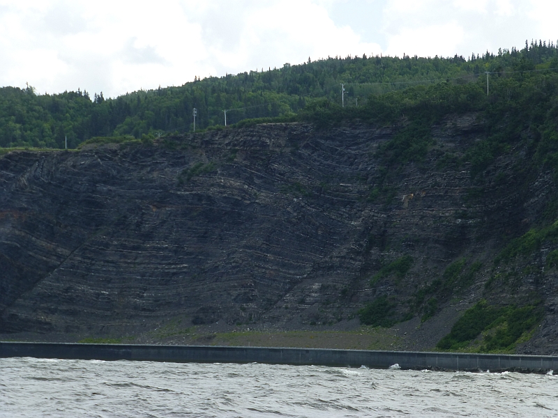
By 9:15 we pulled the mainsail down. We were sailing under only a double reef in the mizzen. There were high cliffs on the riverbank. This is essentially the northern extent of the Appalachian Mountains in North America. (They take up again in the British Isles.) Waterfalls were coming off the cliffs and blowing away in the wind. Very dramatic. We were well out on the Gaspé here. The northern bank had disappeared in the distance. We reached latitude 49.14N here before the shoreline started curving south around the end of the Gaspé.

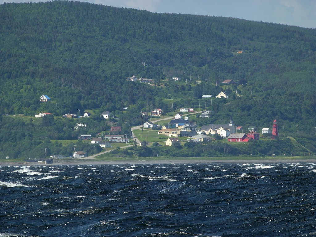


We came in hot into Rivière-Madeleine. We couldn't see the marina over the breakwater rocks. And it was a tight turn around the end, so as we rounded the breakwater, we started the motor and dropped the mizzen. We had to maintain speed to avoid being blown onto the rocks to leeward. The marina is tiny and the docks were right there! Four guys on the dock caught us and stopped the boat before we took out their dock. The docks and boats were jumping. The wind was blowing over the breakwater and the waves were reflecting off the shore into the basin. We put out our fender board and all of our fenders but it wasn't enough. One of the boats loaned us some large fenders which were very helpful
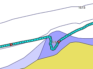
You can see below in the air photo, our GPS track of how we came in. The Garmin electronic chart (right) wasn't very helpful.

Not only is the Garmin lacking detail, it doesn't provide a very accurate chart!
We paid up at the "Capitainery" restaurant at the head of the ramp. The restaurant seemed to do a good local business, food was okay, people very nice (although English was limited). Restrooms and laundry are in a separate building; the waitress has the key to showers (which are free with dock fee, but bicyclists/ walk-ins (campers) can also pay for showers). There were no supplies or anything within walking distance. Our other alternative had been to pass Rivière-Madeleine and head into Grand Vallée, but we found that a couple of the boats in Rivière-Madeleine were from there, and the marina had been destroyed in the winds we'd experienced at Anse à L'Orignal, so it was a good thing we'd decided to head in here.
July 15: Rivière-Madeleine to Grande-Grave, 63nm Make hay while the sun shines! We were headed for Rivière-au-Renard but we had a good wind when we came abreast of the entrance and it was only mid-afternoon so we decided to press on. (we'd also been told it was a bit industrial.) 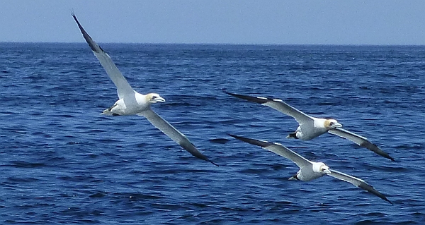 Some large white birds were flying along the cliffs and periodically plummeting into the water for fish. It was an amazing sight, Gina thought they were gannets and we found later that they were. (We were to see many, many gannets in the coming days.) Continuing past Rivière au Renard might have been a bit ambitious, but it's a very industrial harbor behind a large breakwater. We found that Cap Gaspé at the end of the Forillon Penninsula was not as easy to round, nor as close as it appeared. As we approached, the wind became fluky and we entered an extensive tide rip. We motored slowly through as the boat bucked and rolled. We were tired after a long day. Finally we rounded the Cape into Baie de Gaspé and the water finally was calmer. We motored into the sunset to Grande-Grave, a tiny hole-in-the -wall harbor that is entirely constructed with wooden timbers. Entry to Grand-Grave is the narrowest slot ever (we only knew to go here thanks to Livana, we probably couldn't have found it if we hadn't known it had to be there). It's also the smallest basin ever.


This is on the edge of Parc Forillon, where the whale watches and kayak rentals are located. Lots of people were fishing off the breakwater, the basin is wood walls with inset ladders. There's only room for a couple boats - transients tie along east wall, hang on the ladder as you climb up and out. We wandered around looking for where to sign in. We found we could pay at the whale watch ticket booth, but she had to make a call to confirm how to write it up. Rest rooms were across the parking lot at the visitor center which has picnic tables and toilets for all visitors. There's only nonpotable water at the fish cleaning table at the harbor itself.
We were treated to the most beautiful sunset ever, it was about an hour of beautiful color across the water and filling the sky. Gina felt like it was welcoming us to being off the St. Lawrence, promising kinder conditions. Things closed at 8 or 9, then it's very quiet, and remote-feeling. There's a stream at the head of the basin that burbles nicely. A fuel (for whale watch boats) delivery truck was noisy for about half hour after in the dark after everyone had left. It was a beautiful spot for a small boat.
July 16: Grande-Grave to Havre de Gaspé. 15nm The town of Gaspé is 12 miles in at the head of Baie de Gaspé. It was well worth the side trip up the bay. There is an extensive marina (Marina Jacques Cartier) with good facilities (including laundry) on the south side of a high bridge. Entrance is on the far left of the bay. We walked across the bridge to town and had a great lunch in an arty café just up from the bridge. 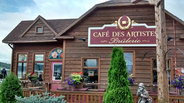
Gaspé has everything you might need or want. There are shops, and a small mall with a grocery store within easy walking distance along a major road from the harbor. The most amazing thing was that the post Office has public restrooms!