Enetai - St Lawrence Cruise, 2014
Part 1: June 27-July 4, Mallets Bay Vermont to Quebec City, 195 nautical miles
This was the inland riverine segment of the trip. All downstream from Lake Champlain, through the Richelieu River and Chambly Canal and down the St Lawrence River to Quebec. We had the mast up for Lake Champlain to St Jean sur Richelieu, mast down through the Chambly Canal and downstream past Beloeil, then put the mast up again by Île aux Cerfs for the rest of the trip.
Friday, June 27: We're off! Drove from our home in Massachusetts to Colchester Vermont.

Our friends, Kim and Will, came with us. They very kindly drove the truck and trailer back to our house. The ramp at Mallets Bay is very busy, but is a good ramp with a long dock to tie to. Make sure you don't have aquatic invasives on your boat or trailer. SeaGrant (Since our boat had only sailed in salt water and in Lake Champlain, this wasn't an issue for us). There is ample parking. We launched in the evening and spent the night at anchor in a cove in the Bay.

Saturday, June 28, Mallets Bay to the Canadian border, 30nm:
To get out of Mallets Bay you go through a cut in an old rail causeway. A Vermont Fish and Wildlife patrol boat hangs out there, checking for fishing licenses, making it look crowded to get through the narrow cut. They were occupied with another boat when we went through. They probably don't have much interest in sailboats, and we weren't fishing anyway.
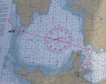


This happened to be Canada Day weekend. There was a vast armada of Canadian sailboats running down the lake from Rouses Point, where they apparently are kept, just south of the border. We passed several dozen large sailboats as we headed for the Richelieu River at the north end of the lake. We entered the river past old bridge pilings, looking like a picket fence across the river, then under a high new concrete bridge.
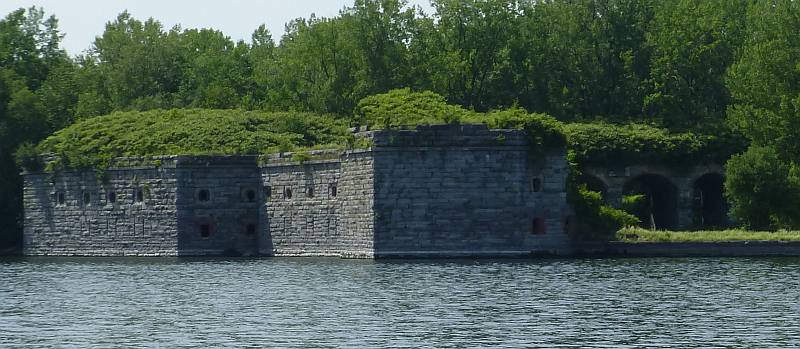
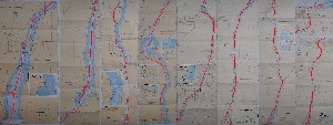
You can see an old fort projecting into the river, but there doesn't appear to be any access (Fort Montgomery). US Customs on a breakwater at the bridge and then Canadian Customs north (downstream) with a small dock and (air conditioned) office on shore. We cleared customs with a few forms to fill out, a short stop, but still time to get thumped against the well-padded dock by several motorboat wakes. These were the first of many, many wakes on the Richelieu, on this very busy holiday weekend. The Richelieu is a long, narrow passage to the St. Lawrence as can be seen on the charts.

We spent the night at anchor out of the main channel. Gina went for a dip (with a fender to catch if the current was too much). It was very hot out.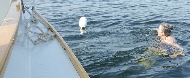
Sunday, June 29, Richelieu River as far as Chambly, 28nm:
Woke up to a deck covered in lightweight dead bugs trapped in the fallen dew and the wind blowing like snot. Fresh river water helped wash the bugs off, but left a gray residue. The guide book isn't always accurate, the rail bridge across the river supposedly begins operation at 7:00 am. Here is the bridge operator climbing up to the control shack at 8:05.


We waited more or less patiently. (We did not blow the air-horn.) It takes a few days to relax at the beginning of a cruise. We sailed, mostly, down the river to the town of St. Jean sur Richelieu. We tied up at the marina near the entrance to the Chambly Canal and took down our main mast. The mizzen is short enough to clear all obstructions on the canal. (I checked and double checked the "air draft" of both masts before the trip. Don't want to make a mistake here.) We 'practiced' our French: had a very nice lunch at the marina, got ice for the cooler, and headed into the canal. We didn't really have a goal for the day. It would have been nice to explore the town but the canal beckoned and we decided to push on to Lake Chambly. The Richelieu is pretty much a motor boat place.
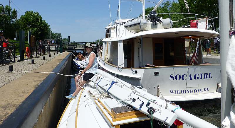
We waited on a dock for the 1 PM opening of the locks, and followed the Soca Girl into the first lock (ecuse, in french) and lowered a few feet. We kept the same pattern in each lock as we transitted the canal. The speed limit is 10 km/hr (about 6 knots). Soca Girl was moving a little faster at first while we struggled to keep up. When it became clear that the authorities were not going to let Soca Girl lock through without us (the authorities radio'd her to slow down), she backed off a little on the throttles and we were able to keep pace, but we were motoring about as fast as we could. There are also several bridges that have to open and let boats through. We locked through 9 locks in about 5 hours. The canal follows the West Bank of the river with occasional views to the east where you can see the river rapids that make the canal necessary.
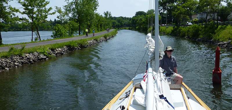
A small motor boat with four twenty-somethings had darted into the first lock ahead of both us and the Soca Girl. They stopped at a dock by the third lock and then it was just the two of us. Pretty quiet except for the diesel ahead. There's a fairly historic town in the first third of the canal, and a stretch with homes lining it, but mostly the landscape is rural-looking. There's a nice bike path along the canal.
The locks were operated with mostly college students. They throw you thick mooring lines and you hold on to them and pay them out as the water drops. So you really need two people. The second person on the motor yacht ahead of us didn't seem to like to come out so, at each lock there was this inside/outside thing going on as they got the lines. Each lock lowered us about 8 feet.
The second half of the canal, the banks were busy with people enjoying the beautiful weather on this holiday weekend. The bike path that follows the canal is popular.
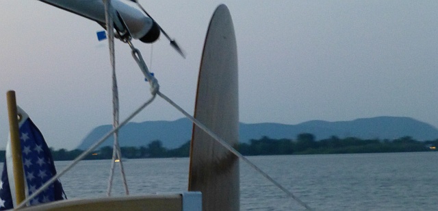
The canal ends with two sets of close locks separated by about a half mile of wider canal on the outskirts of Chambly. At the first of these ( about 4 PM), they asked if we wanted to tie up above the last set since it was close to 5 PM. We opted not to and were glad we had continued, because it was such a relief to reach the open water of the lake and a breeze! There were some boats tied along the dock before the last set of three locks at Chambly, with easier access to town, but no breeze.. There's a staircase of three deep locks in a row that lower you to lake level. When the last gate opened, it was like the gates of heaven opening out to this beautiful vista, the lake with Mt. St. Hillaire in the background; After the constraints of the canal and the airless heat going through the locks it was wonderful to emerge into beautiful Lake Chambly.


There's a marina just east, almost tucked behind the east side of the locks as you enter the lake. It was full of motor boats shining in the hot sun. We opted to turn west and anchor among some other anchored boats and some crazy activity, the most fascinating of which was jet boots. Mont Saint-Hilaire dominates the Eastern shoreline.
That was a long day.
Monday June 30, Chambly to Parc Bellerive, 28nm:
We inflated our kayak and ventured ashore despite threatening rain. After walking over to the fort at the base of the rapids (protecting what from whom? The rapids don't seem to need guarding, but I guess canoes were sneaking around during the several wars in past centuries) and exploring, we headed back. We spotted a very pink café and stopped for a really great breakfast at Dame Tartine- superb! The Canadians are really good at a) fresh fruit b) bike and walking trails and c) public gardens. Probably a reaction to the long winters.
We accessed wifi and realized we didn't have tracking turned on on our DeLorme, so we fixed that.
Then we were off down the Richelieu again. There were several low bridges, such as this one. A gap appeared, tight to the west shore around the bend, at the last moment.


We passed several cable ferries that never bothered to turn off their flashing warning lights, even when they were on the bank loading cars, leaving us dithering over when it would be safe to proceed. The motorboats seemed to know this and ignored all lights and ferries (as well as no-wake zones!).

There were marinas on both sides of the river, all with floating signs pleading "pas de vague S.V.P" to no effect. We paused at Iles aux Cerfs, which has a well-marked no-wake zone because of endangered species: chevaliers cuivres, or copper redhorse, which turned out to be a little fish, that's only found in Quebec, and is in peril. Here we put the mast back up, but saw no chevaliers.
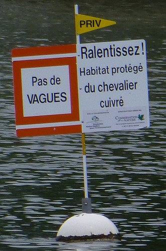

Turns out, the Canadians pretty much ignore the no wake zones, not even slowing for le chevalier cuivré. We tucked between two islands and no wakes tweaked the boat while we walked the mainmast up and lowered it into the step - but only because no boats passed while we were stepping it. This is a delicate operation, even without wakes. Nice to be whole again. But we came around a bend and saw another low-hanging power line. We made a "screeching" U-turn and headed back up the river while we figured out how that power line got there and what the clearance is. We found the faint gray line on the chart with a clearance of 15 meters. Our air draft is 10.3 meters but it looked closer than that as we crept under the power line.
There is one more lock at the "chutes" at Saint-Ours. They call it a canal but it is just a long lock. This lock has a dock that you tie up to. A bit further downriver, we stopped for the night at the marina at Parc Bellerive.

Besides a full service marina, this is a cozy campground. Most of the trailers/campers looked to be permanently installed as a summer colony of sorts. We walked out to the road to see what we could see. We passed a number of red signs "NON gaz de schiste" - pretty far from the oil shale! Across the road was an extensive boat dealership/ repair yard/ chandlery. Off in the distance to the north we could see sailboat masts. We walked about a half-mile down to a mast-up boat storage yard across the road from the river. Here there were ranks of ocean-going sailboats in cradles out in a field. Some were for sale, others apparently waiting for the next voyage.
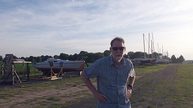
Maybe they were all for sale. They looked pretty forlorn, far from the sea. We were not really that far from Montreal where I'm guessing most of the owners live.
Tuesday, July 1, Canada Day, Parc Bellerive to Trois-Riviére, 42nm: Moving right along, we motored a few miles down to Sorel (or Saurel) where the Richelieu joins the St. Lawrence. As we entered Sorel the wharves on each shore narrowed the river. Here's where quite a few large ships were undergoing maintenance. Rusty ships and tugboats lined the channel. Finally, we emerged between a cargo wharf and a cement silo into the St. Lawrence River.
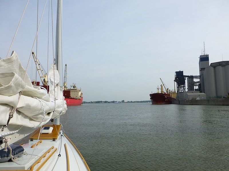
We stopped at the Parc nautique Federal to top up our fuel.

We walked into town in search of breakfast. Sorel appeared to be hung over from last night's holiday festivities. The town square was almost empty and what stores and restaurants there were weren't open yet except one restaurant on a corner a couple blocks from the square was totally packed. Skunked. It was already so hot, we got some iced tea at a liquor/convenience store. Back at the boat we cast off and headed out across Lac St. Pierre.
We had a gap in our charts here. Charts 1312 and 1313 had been out of stock when we purchased our stack of charts. Back at Parc Bellerive, we had asked for information at the mobile trailer park entry kiosk. The nice young lady there had a "placemat chart" of Lac St. Pierre which she gave to us.

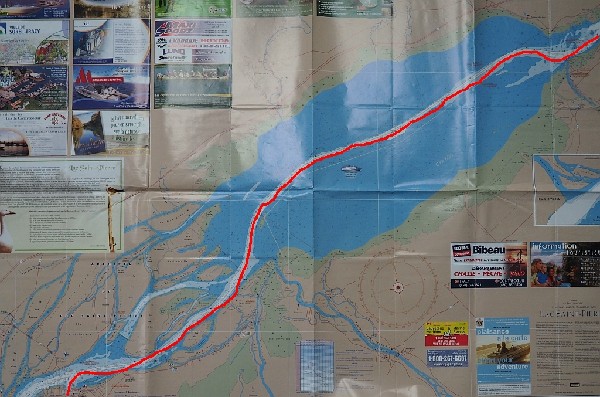
"Le Îles de Sorel et Berthier" at the west end of the lake looked like excellent gunkholing but the wind was good for crossing the lake. Lac St. Pierre is so wide you can hardly spot the shores, and shallow, with a dredged shipping channel down the middle. It was strange to be way out in a lake many miles from land with shallows on both sides. There were occasional piles of rubble that seemed to mark the channel.

We encountered several ships and a Coast Guard cutter but the channel was wide enough to stay clear. In the afternoon the wind piped up as we approached the far 'outlet' back into the river.
As Lac Saint Pierre ends, the river narrows at the high Trois-Riviéres bridge. We sailed past several ships at anchor just upstream of the bridge (presumably waiting for the end of the holiday) We hoped their anchors were holding well against the wind and current.

We slid past the waterfront, a few miles down from the bridge where Trois-Riviéres was still celebrating Canada Day weekend with live music in an amphitheater.
Trois-Riviéres marina is past the city, on Île St. Quentin which is a park. The breakwater runs along the St. Lawrence, and you enter by the river mouth, and turning sharp sw into the marina. It's a little tight in there especially if the wind is blowing. There's a fuel dock on the breakwater side. Administration is in the corner of the building nearest the docks. Gates work by key card, on which there's a deposit. There's a snack window with food and beer. Of course we were intrigued by Hot Dog Michigan, turns out it has to do with chili on a hot dog - who knew? We've been to Michigan and never saw that.

In between, there's a door to a corridor that goes to the restrooms, and there's like a second restroom with the shower beyond the second one. (At the end of corridor is banquet room, and we came to realize that the facility probably does most of its business as a wedding venue). The island is a park, the trails are very nice. It's pretty far from the city (evidently it's common to have the marina call a taxi), but we were probably the only transient there. The wind had been building all day and we had to motor into it to get into the marina. We managed to get Enetai into her assigned slip without hitting anything (but we scared ourselves and some of the marina patrons) just before a vicious squall came through. We ended up moored stern to the wind and had a few very wet moments while we struggled to get the hatch boards in.
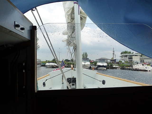
After the squall moved off we went for a nice walk on the boardwalk over the marsh behind the marina. We were tired and decided Trois-Riviéres would have to celebrate without us.
Wednesday, July 2, Trois-Riviéres to Quebec City, 67nm:
Today, we were on a schedule. With careful timing, it is possible to get from Trois-Riviéres to Quebec City in one tide. There is no actual flood tide at Trois-Riviéres but the ebb is felt as an increased current . Below Trois-Riviéres the tide begins to dominate the flow. We left at 8:00 AM and headed down the river. The shoreline from here all the way down the river and out the Gaspé is shallow and when the tide goes out you can see that the mud is studded with rocks.

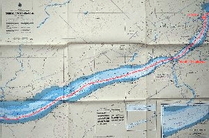
We went briskly though the Richelieu Rapids. The river is a little spooky here with high shores closing in. There were current lines and boils in the water. The channel is well marked with buoys and range lights.

We briefly considered Portneuf as a stopping point as we swung around the bend in the river but conditions were good so we pushed on for Quebec City.
The weather did come in with lowering clouds and gusty winds as we approached Quebec. The ebb was running strong as we passed under the highway and railroad bridges where the river is constricted. We hit 11 knots on the GPS (a speed heretofor unheard of in Enetai)!
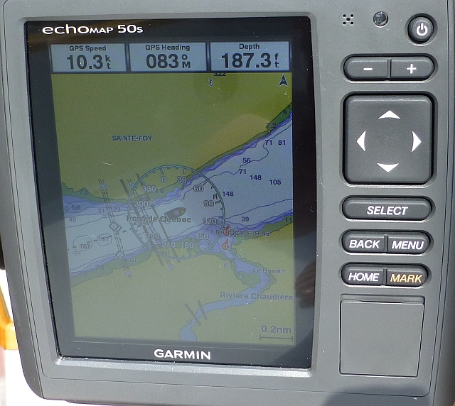
We could see a squall approaching as we ran downriver past the waterfront towards the Port of Quebec marina. We passed this ship full of wind turbine blades. 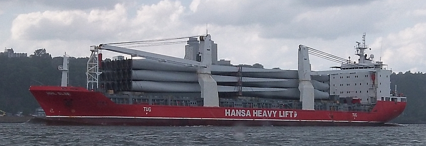
It was too muggy for foul weather gear so we changed into swimsuits. We dropped the sails and locked through to the boat basin in the driving rain. While in the locks we saw no one, it all worked automatically after we'd radio'd and gotten the go-ahead. It's so enormous, it was a little eerie in our small sailboat with the huge machinery working the locks and no-one to be seen.

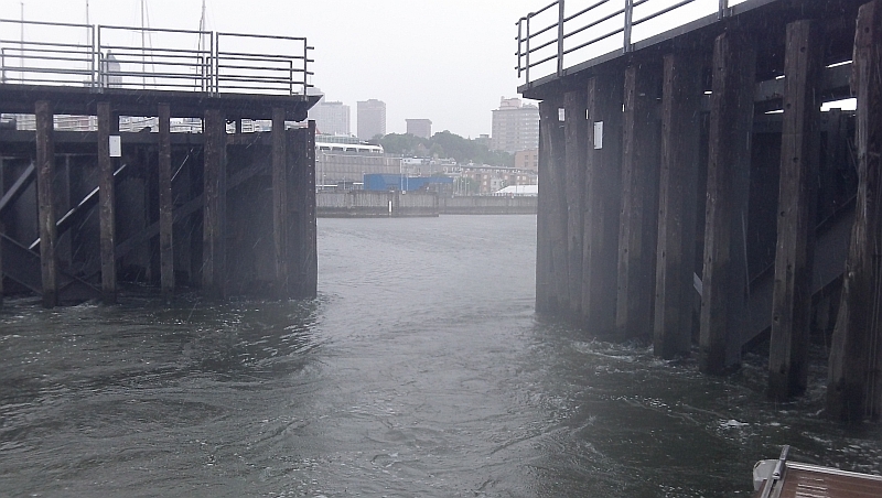
Enormous locks let you into Basin St. Louise. The locks opened up and there wasn't a sound but the pouring rain, not even a peep on the radio. As the locks opened into the boat basin, we could hardly see to read the numbers on the floats to find our assigned slip. Then the sun came out and we took a look around. What a magnificent scene! The boat basin is located right in the city at the foot of the hill.
The Marina Nautique at Basin St. Louise is entered through the one large lock, there are docks you can tie up to and wait on if necessary, and the area is protected within an artificial harbor. There are a few large ships in the 'outer harbor', and the largest yachts (that wouldn't fit in the marina) can tie up out there. The lock at Basin St. Louis is large and remarkably fast and quiet, swinging hydraulic gates. A bridge over the lock also has to be opened, the cleats on the dock are marked to avoid the bridge. 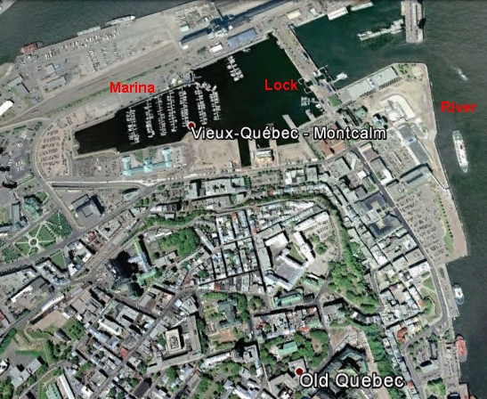
Once in the marina, all we had to do was walk around the end of the basin to get the whole Quebec experience. We ended the day with a delicious dinner at a Greek restaurant at the foot of the hill. We sat in the sidewalk table area and unwound from the 67 mile sprint down the river.
The marina is large, new and well appointed. The Administration is on the second floor of the building. Again key cards are used for docks and showers (showers are included in the dock fee and are very nice). Ice and fuel are available. This is a very nice facility right on the edge of Vieux Quebec, a fantastic place to stay. A kitchen and area to grill are to the west of the administration building; take the path west around the basin, or cross the bridge to the south, and you are in the city itself. To the north, a 10-15 minute walk beyond the train station is a mall with a Metro grocery at the end (under the highway bridge).Then at nightfall we were in for a surprising treat. There's a large industrial concrete facility with multiple grain silos on the east edge of the marina. While it 'breathes' with a periodic hiss until about midnight, at nightfall the aurora borealis plays along the silos. It's a remarkable and lovely sight, transforming the concrete into a light show.
July 2-4: Quebec City.
We had a great time exploring Quebec from the old city to the Charles River (yes Boston, the Charles; with no locks, much muddier than Boston's tamed Charles). The Embarkment, the Plains of Abraham, the Citadel, the beautiful parliament building with an informative tour, it's a beautiful place. AND while missing our Fourth of July which we usually enjoy watching fireworks from the boat, it was their summer celebration (concert fencing was being installed all along the plains) and we were surprised one night, during a pouring rainstorm, to suddenly hear booms and to see fireworks going off over the far side of the City at 11 PM on the 3rd! (We have already larded this page up with too many pictures so we are leaving out all the tourist-pictures of Quebec. You're welcome.).
For lovers of Doctor Who, we also were surprised to discover what looked like the crack in the universe in a painting at the train station café. Restaurants, cafés, shops, history, flowers, fountains: it was tough to leave such a fun place with so much to see, but we had a long distance with many unknowns, and so headed out early on a Saturday, after a short panic about whether the locks would be too busy to fit our little sailboat on a Saturday morning. But things were quiet on the water yet again.